
Traffic Scout is a powerful yet easy-to-use tool designed for traffic planners to monitor, analyze, and forecast urban mobility patterns. By combining real-time traffic data, predictive analytics, and impact assessment tools, the app helps cities reduce congestion, improve road safety, and support carbon-neutral transportation planning.

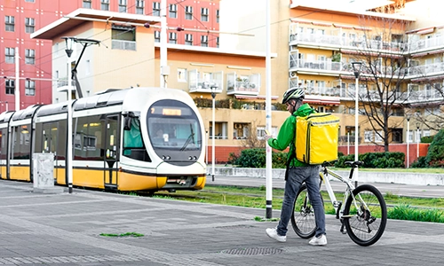
Leverage real-time mobility data to prioritize sustainable transport modes such as walking, cycling, and public transport while optimizing road usage and alternative routes to reduce high-emission areas. By integrating real-world traffic impact assessments, cities can make informed decisions to support low-emission zone (LEZ) planning and create more sustainable urban environments.

Identify high-risk areas to implement traffic calming measures and enhance road safety while leveraging predictive analysis to anticipate congestion and prevent potential road hazards. Provide emergency response teams with real-time incident insights, enabling faster and more effective interventions to improve overall urban mobility and safety.

Evaluate the impact of traffic policies and infrastructure projects on emission reduction and safety goals while utilizing before-and-after analytics to measure the effectiveness of new public transport routes or road redesigns. Strengthen the case for sustainable mobility solutions by providing data-backed reports that justify funding and demonstrate measurable improvements in urban transportation.
Our smart mobility analytics platform empowers cities and urban planners with data-driven insights to optimize transportation networks, enhance sustainability, and improve commuter experiences. By leveraging AI and real-time data, we provide a comprehensive solution to tackle traffic congestion, reduce emissions, and integrate seamlessly with existing infrastructure.
mobility insights
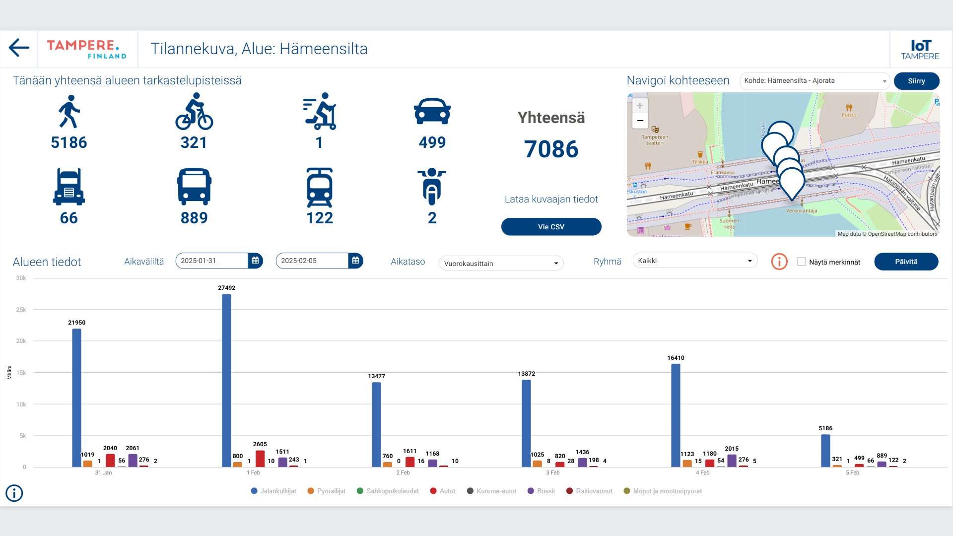
Monitor traffic volumes, congestion hotspots, and transport mode distribution to make informed planning decisions.
traffic and emission forecasting
Use AI-powered models to analyze the impact of new roads, transit routes, or low-emission zones on congestion and CO₂ footprint.
integration with city systems
Connect with existing sensors, traffic lights, and mobility platforms to reduce implementation time & costs.

TrafficScout creates measurable value by helping the city target mobility investments to the right locations and then verify whether walking, cycling, e-mobility and public transport are actually increasing — and private car traffic decreasing — in line with the city’s targets and Low Emission Zone planning.
If better mode-split measurement and forecasting improves the targeting and prioritization of mobility infrastructure investments by even 5–10 percent, the annual benefit in a Tampere-scale city can be approximately 250,000–750,000 € through avoided mis-investments, faster learning cycles, and higher impact per euro spent.
In addition, if TrafficScout-supported measures help shift even a small share of trips in the city center from private cars to low-carbon modes, the impact becomes measurable in emissions. For example, a 1–2 percent shift in city-center car travel can typically translate into 100,000–300,000 € annual value when combining CO₂ reduction (using standard €/tCO₂ valuation) and reduced car-use related external costs.
Modern traffic optimization starts with seamless data integration. TrafficScout supports a wide variety of infrastructure and sensing technologies, turning your city’s existing assets into a unified, AI-powered traffic intelligence system.
We integrate with:
- EcoCounter pedestrian and cyclist counting devices
- Traffic light control systems for adaptive signal timing
- Inductive loops for vehicle detection
- Smart micro-radars and IoT sensors
- ANPR cameras and LPR systems for vehicle recognition
- Open APIs and real-time feeds from city infrastructure
These data sources are harmonized on the IoT-TICKET platform and combined with machine learning models to deliver forecasts, heatmaps, congestion alerts, and actionable planning insights.
To activate TrafficScout, cities provide access to their existing measurement infrastructure—such as traffic counters, light controllers, or radar sensors. Our flexible integration layer supports most industry-standard interfaces and protocols, ensuring fast deployment with minimal changes.
TrafficScout operates fully within GDPR, ISO 27001, and other security standards. No personally identifiable information is stored or tracked—only anonymized traffic patterns and flow metrics are processed for decision-making.
Axis TIP (Technology Integrator Partner
AI based machine vision with central processing enables you to use traditional city CCTV cameras to generate traffic data. This is a very cost efficient way to introduce new traffic measurement points in your city. The system also allows integration of the most used machine vision cameras to push preprocessed data to the app.
- Instant Access to Traffic Insights – Monitor real-time traffic data, analyze mobility trends, and make informed planning decisions.
- AI-Powered Predictions – Use advanced forecasting to optimize road networks, improve safety, and reduce congestion.
- Seamless Integration – Easily connect with your existing city infrastructure and data sources.
Getting started
- Book a Demo – See Traffic Scout in action with a guided walkthrough.
- Start a Pilot – Get hands-on experience with real-time traffic data.
- Full Deployment – Our experts help you scale the solution city-wide.
We’re Here to Support You! Our team provides full onboarding, training, and continuous assistance to ensure your success.
Get
started
Want to learn how you can accelerate your business creating market ready apps and services stunningly fast with IoT-TICKET?
IoT-TICKET brought to you by:
Founded in 1999, Wapice is a Finnish full-service software company whose solutions are used by domain leading industrial companies around the world. We offer close technology partnership and digital services to our customers.
© 2025 Wapice Ltd.
All rights reserved